Sepik River Basin
| Status | Threatened |
| Country | Papua New Guinea |
| Report By | David Curiel |
| Posted | December 16, 2009 |
| Updated | December 16, 2009 |

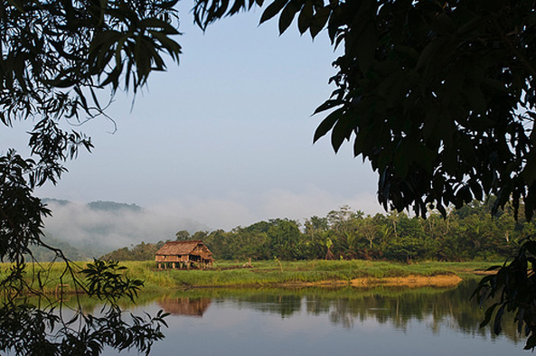
Winding down from the timeless cloud forests of New Guinea’s Central Range, the Sepik River’s majestic folds form the core of one of the largest and most intact freshwater basins in the Asia Pacific region. The soul of Papua New Guinea, the Sepik is often compared with the Amazon and the Nile, and it sustains an amazing variety of flora and fauna — much of it endemic — along with a wellspring of human cultural expression. In particular, many of the region’s people are economically, culturally and spiritually tied to the crocodiles of the river. While logging, mining and large-scale agriculture operations have been threatening forests, rivers and wetlands in many parts of the country, the Sepik region has remained essentially unspoiled, the river serving as a vital source of food, water, transportation and community identity. However, a new copper and gold mine, projected to begin operation on the Frieda River in 2017, threatens the pristine status of the Sepik system. According to Andrew Moutu, Ph.D., a Sepik man and a lecturer at the University of Adelaide, Australia, “If the mine comes into operation, the people and villages of the Sepik River located below the Frieda River will be severely affected and we will lose everything that defines Sepik River societies.”
The Land and Its People
Papua New Guinea occupies the eastern half of the Melanesian island of New Guinea and several smaller islands. The country’s motto, “unity in diversity,” is apt: it is one of the most ethnically and biologically diverse countries in the world. Some 60 percent of this mountainous land is covered by tropical forest — representing, along with neighboring West Papua, the world’s third-largest intact rainforest — and the forests contain an estimated 5 to 7 percent of the world’s biodiversity.
There are more than 800 indigenous languages among the people of Papua New Guinea, and a stunning range of cultural diversity. Most people live in small communities, where they practice subsistence farming and depend on the forests to provide their food, medicine and building materials. Rather than being bought and sold, land is passed down through generations, and it is a source of identity and spiritual connection as well as survival. Ninety-seven percent of the land in Papua New Guinea is under legally recognized customary-land title, meaning that the country’s indigenous people have rightful ownership of the traditional lands they occupy.
Seven hundred miles in length and with a catchment area covering nearly 30,000 square miles, the Sepik River occupies a special place in Papua New Guinea. It is the largest unpolluted freshwater system in all of New Guinea and it holds some of its rarest plant and animal species, including two species of crocodile — one saltwater and one fresh — upon which the peoples of the river’s middle reaches are economically reliant. The region is one of the least economically developed in the country, and its 430,000 inhabitants depend on the forests and river for their livelihoods. The area is also one of the world’s most culturally and linguistically diverse, home to over 300 languages in an area a bit smaller than the state of Texas.
Crocodiles feature prominently in the legends and rites of passage of various Sepik tribes. Stories may vary from village to village, but there is a shared belief in ancestral ties to the crocodiles and a practice of ritual scarring of initiated men that emulates crocodile skin. Descending from traditionally male-dominated warrior cultures, the men still congregate in intricately carved “spirit houses,” known in the pidgin colloquial as haus tambaran, to debate village matters. The artisans who carve the house posts, orators’ stools, ceremonial hooks and other features found within the houses are honored within their tribes, a practice that has led to a thriving art-carving trade well known among Asian Pacific native-art collectors.
Among some peoples, including the Bahenimo of the Hunstein Range in the Upper Sepik region, certain parts of the land carry taboos because they are viewed as dwelling places of spirits, or masalai. Although lifestyles among the people of the Sepik are changing slightly as a result of outside influences, most traditional believes continue to be valued.
Current Threats and Preservation Efforts
For the past two decades, industrial logging has been the most significant cause of forest loss in Papua New Guinea, and logging companies often use cash and other incentives to lure traditional communities to sign over their lands. Large-scale monocrop agriculture often then moves into the newly cleared land, with further destructive effects to the environment and local communities. Fortunately, the Sepik River Basin has remained a largely unspoiled — but that may change with the development of a large-scale mining project.
Located near the headwaters of the Sepik on the border between East Sepik and Sanduan (West Sepik) provinces, the Frieda River mine aims to tap one of the world’s largest undeveloped copper and gold deposits. Initially developed by a subsidiary of Australia-based Xstrata Copper, the mine is now jointly owned by PanAust (80%) and Highlands Pacific (20%). The project is currently in the feasibility-study stage but is expected to begin construction in 2015, with production starting up in 2017.
Xstrata had pledged to conduct operations at the Frieda River mine in an environmentally and socially responsible way (see Xstrata’s 2008 sustainability report in the source list below), but critics including Andrew Moutu have expressed concern that environmental plans have not been made public and villagers of the Upper and Lower Sepik have not been adequately involved in the planning process. Of primary concern is that mine tailings might make their way into the river system. Discharge of millions of tons of waste from the Ok Tedi mine in neighboring Western Province resulted in a bona fide environmental disaster affecting some 600 square miles of land and at least 30,000 residents of the Fly River system; the Frieda River mine is expected to be an even larger operation than Ok Tedi. The new owners, PauAust and Highlands Pacific are reviewing feasibility and cost models.
Writing in PNG newspaper The National, Moutu said, “I want to challenge and appeal to all the educated people of Sepik River societies throughout PNG to mobilize and address the question of a Frieda River mine before we dig and bury ourselves in the coffins of mineral intoxicants. As feasibilities are being carried out, we have the right to demand a sound environmental plan that incorporates all and every concern about our crocodiles and humans, fish and sago, water and contaminants, eels and mayflies, birds and mosquitoes, men’s houses and churches…”
That the Sepik River Basin has until now avoided the fate of other areas of PNG has been credited in part to the region’s designated protected areas and the implementation of sustainable economic practices for its people.
An 850-square-mile area of the Hunstein Range highlands in the Upper Sepik was declared a national Wildlife Management Area (WMA) in 1998 to prevent the largest proposed industrial logging effort in the country. In October 2005, the government announced it would gazette two adjoining WMAs, the 140-square-mile Uma and 42-square-mile Me’ha, creating the country’s largest lowland-rainforest protected area. The new WMAs, which are still awaiting final gazetting, are located in the lower catchment of the Nisek River, a tributary of the Sepik, and supply wetlands that are a breeding habitat for the country’s largest crocodile populations.
WMAs, which encompass land owned by customary communities, are established at the request of the communities and with their own rules and management committees. The goal is to provide environmental protection and opportunities for sustainable development while also strengthening land rights and preserving cultural and sacred sites. In the case of the Sepik WMAs, rules protect core forest areas from logging, place traditional restrictions of the hunting of certain animal species, and forbid disturbance to masalai areas. The Uma and Me’ha WMAs are also intended to help the communities sustainably exploit gaharu, a fragrant wood used in the manufacture of incense, perfume and medicinal products.
However, WMA projects are not without detractors. According to a report for the Australian Conservation Foundation, the projects’ compensation model — that is, providing material incentive, typically in the form of economic development, in exchange for the local agreement to protect natural areas — “assumes that local poor people are likely to be driven to destroy the natural value of their locale, and have few of their own, indigenous resources for environmental management. In addition, the [WMA project] may position itself as a competitor with logging and other destructive resource industries seeking to ‘buy’ the favor of local communities.” Others criticize the WMAs as nothing more than “paper parks.”
An area encompassing the middle and upper reaches of the Sepik River Basin is currently being considered for inclusion in the UNESCO World Heritage List as a mixed natural and cultural heritage site. UNESCO helps countries to protect their World Heritage sites by providing technical assistance and professional training and supporting public awareness-building and conservation activities.
Among the villages along the river, crocodile eggs are a valued commodity, and some years ago overharvesting along with fire- and invasive-species–related wetland deterioration had begun to create a critical situation in the crocodile population that could have very quickly affected the livelihood of all the surrounding villages. In 1998, some local stakeholders and outside agencies formed the Sepik Wetlands Management Initiative to address some of the underlying issues, and it evolved into a broad community-based organization that now sustainably harvests crocodile eggs and skins as well as mapping their nesting habits, all while protecting and developing the wetlands associated with the Sepik River.
A 2006 crocodile population count showed the wetlands project had effectively reversed the decline observed from 1988 to 1998, recording the highest numbers since aerial counts started in 1982. In recognition of its accomplishments, the initiative was a 2006 U.N. Development Program Equator Award finalist.
What You Can Do
If you plan to visit the Sepik River Basin, download the ecotourism guide “Sepik River: Nature and Community Tourism” and see “Ethics for Visiting Sacred Places” for more guidance.
Ask questions about environmental planning and engineering at the proposed Frieda River Mine. Where would the waste go? What benefits would local communities receive? What do local communities want? What kind of consultation and information sharing is going on and how many community members are informed?
Sources
Anderson, T. “Papua New Guinea’s Bismarck Ramu Group: Redefining ‘Conservation and Development.’” Melbourne: Australian Conservation Foundation, 2004.
Divine Word University and WWF. “Sepik River: Nature and Community Tourism.” (PDF)
Embassy of Papua New Guinea. “Papua New Guinea Wildlife and Environment: PNG Government/NGO Approach to Conservation.” Embassy of Papua New Guinea to the Americas, Washington, DC.
Highlands Pacific Group. “Frieda River Fact Sheet.” October 2008. (PDF)
Kirsch, Stuart. “No Justice in Ok Tedi Settlement.” Cultural Survival Quarterly, Summer 2004. (PDF)
Moutu, Andrew. “Frieda – another ecological disaster?” The National, May 5, 2008.
Moutu, Andrew. “Is There Such a Thing as an ‘Environmentally Friendly Mine’?” The Melanesian, June 24, 2008.
Peter, David (Freshwater Program Manager, WWF Papua New Guinea). E-mail correspondence, March 1, 2009.
Sepik River Wetlands Management Initiative. “Equator Prize 2006 Nomination File.” UNDP Equator Initiative Knowledge Base. (DOC)
United Nations Educational, Scientific and Cultural Organization. “Upper Sepik River Basin.” UNESCO World Heritage Centre.
WWF. “Uma and Me’ha Wildlife Mangement Areas.” July 10, 2008. (PDF)
WWF. “Upper Sepik, Papua New Guinea.” Forests of New Guinea.
WWF. “New Ways to Explore the Pacific’s Last Great Wilderness.” News release, March 6, 2007.
Xstrata Copper. “Frieda River Project: Sustainability Report 2008.” (PDF)